
Key Takeaways
- Land surveying is essential for defining property boundaries and preventing disputes.
- Accurate surveys support infrastructure development, including roads, utilities, and public facilities.
- Modern technologies like GIS and drones have revolutionized the surveying industry.
- There is a growing demand for skilled land surveyors to support community growth.
Table of Contents
- Defining Property Boundaries
- Supporting Infrastructure Development
- Facilitating Environmental Conservation
- Leveraging Modern Technologies
- Addressing the Surveyor Shortage
- Enhancing Community Engagement
- Conclusion
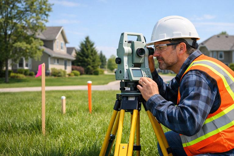
Land surveying is at the heart of successful community growth and development. With accurate measurements and mapping, communities can plan infrastructure, clarify property rights, and protect sensitive environments. Anyone interested in property or community planning can benefit from understanding how land surveying shapes the foundation for progress and sustainability in urban and rural settings alike. Whether building new neighborhoods, upgrading public utilities, or conserving local habitats, the input of professional surveyors is critical. Their expertise ensures that projects meet legal, environmental, and regulatory standards, directly affecting the well-being and resilience of communities for generations. With so much riding on their work, it’s no surprise that the demand for skilled surveyors continues to rise. Many of the benefits provided by land surveying can be attributed to the highly trained professionals in the field. If you are interested in learning more about the local experts behind these essential services, visit your local surveyor resources for insights into the profession and its impact.
Defining Property Boundaries
Clearly defined property boundaries are a cornerstone of both residential and commercial development. Accurate land surveys prevent disputes between property owners and establish the legal parameters for what can be built or modified. This is especially important in growing communities, where even minor boundary errors can escalate into larger legal and financial conflicts. By marking physical property lines, surveyors help property buyers and sellers feel confident in their investments. Government agencies and developers also rely on these surveys to enforce zoning laws, maintain public records, and safeguard the interests of all stakeholders involved.
Supporting Infrastructure Development
Infrastructure projects, from roads and bridges to water systems and schools, all require meticulous planning based on precise data. Surveyors provide the topographical and geographic information needed for engineers and planners to design safe, compliant, and efficient public works. Their measurements inform placement, grading, and alignment to minimize risks and maximize long-term value. Without accurate surveying, infrastructure projects may face costly delays, legal challenges, or even structural failures. For a deeper look at the broader impact of infrastructure planning, visit the American Planning Association’s Planning Magazine for insightful research and case studies.
Facilitating Environmental Conservation
Protecting the environment is an essential responsibility for any growing community. Land surveying plays a key role in mapping wetlands, flood zones, forests, and habitats that must be preserved during development. By defining these sensitive areas with precision, surveyors help guide sustainable land use and ensure regulatory compliance. Survey data is often used to assess environmental impact and to inform mitigation strategies. This proactive approach enables communities to strike a balance between growth and stewardship of natural resources, which is vital for long-term prosperity and disaster resilience. For additional information about environmental protection standards in land development, the Environmental Protection Agency’s land use resources provide comprehensive guidelines.
Leveraging Modern Technologies
Technological innovations continue to reshape land surveying. Geographic Information Systems (GIS), drones, and advanced software tools have made data collection faster and more accurate. These advances allow surveyors to cover larger areas with greater detail, making their findings more reliable for developers, municipalities, and conservationists. The ability to visualize three-dimensional mapping data has become crucial for complex development, urban planning, and risk management. Technologies like drones can provide up-to-date aerial imagery and comprehensive topographic data in a fraction of the time required by traditional ground-based methods. With these tools, surveyors can troubleshoot potential issues before they arise, significantly reducing project delays and overruns.
Addressing the Surveyor Shortage
The surveying profession faces a looming workforce gap as many experienced surveyors approach retirement. Educational programs, scholarships, and outreach efforts are underway to attract students to this critical field. Training in both classical surveying techniques and emerging technologies ensures new professionals can meet modern demands. Initiatives to improve STEM education and raise awareness about surveying careers are crucial for maintaining the talent pipeline. These efforts are supported by industry organizations and local governments, all of which recognize that community growth depends on the ongoing contributions of skilled land surveyors.
Enhancing Community Engagement
Modern surveying extends beyond measuring land. Interactive GIS maps and visualizations invite residents, business owners, and officials to participate in planning and decision-making. When the public has access to clear, comprehensive data, it fosters trust and consensus on important projects. Online platforms and public meetings often build on survey data, empowering individuals to voice concerns, suggest ideas, and explore how proposed projects may affect their neighborhoods. This collaborative approach leads to more inclusive and sustainable outcomes that benefit the entire community.
Conclusion
Land surveying is foundational to healthy community development. It underpins legal certainty, infrastructure quality, environmental care, and public engagement. As communities grow and evolve, ongoing investment in both people and technology will ensure that land surveying remains a trusted resource for sustainable progress and stability.